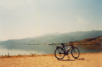
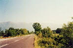
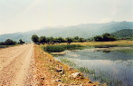
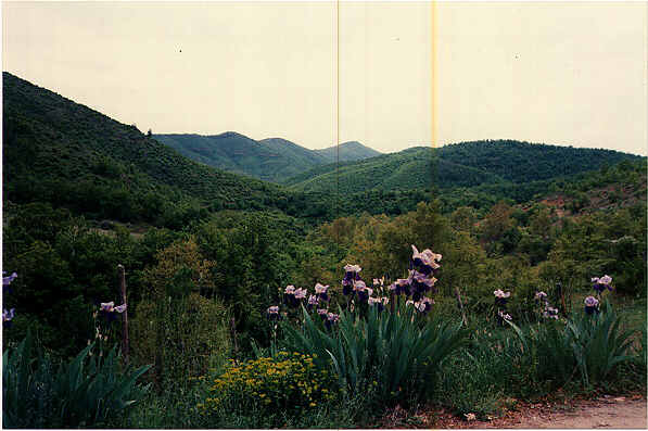
 Carefree cycling... The Krousia mountains in the background Click here for a bigger (66K) version of this picture
by Bryan Hollamby
G r e e c e. Country of white light, ultramarine seas, golden retsina wine and dark green fir trees. Most tourist visitors to Greece head for the islands of the Aegean or the Ionian, to Crete or Athens. However, for the touring cyclist there is much to be gained by exploring the Greek mainland, apart from the fact that cycling on islands inevitably restricts cyclists to a small land mass and makes them dependent on ferries.
Northern Greece (with the exception of the Halkidiki (also known as Chalkidice) peninsula) receives far less than its fair share of tourism, which perhaps makes it even more suitable for the cycling tourist. I have lived in Northern Greece since 1986, after my first 23 years in England. Although for much of that time I did not even own a bike, a love of cycling naturally enough stayed with me. Before coming to Greece I used to do a lot of cycling around the Midlands of England, as well as in the north-east, in the Dales of North Yorkshire, on CTC (Cyclist's Touring Club) runs as well as alone. My favourite memory from those days is a 13-hour 250 km run from Birmingham (central England) to Portsmouth (south coast of England) following as straight a line as possible, which involved following the beautiful lanes through the rolling landscape of the South of England. But that's another story and - hopefully soon - another webpage...
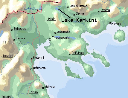 The position of Lake Kerkini. Click here for a bigger (175K) closer view of the immediate area around the lake These maps are reproduced from Microsoft's Encarta 96 World Atlas (stated for purposes of their copyright).
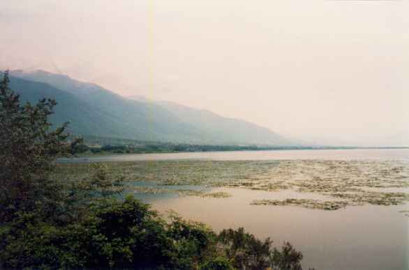
Lake Kerkini is situated south of the Greek-Bulgarian border, in the county of Serres. It is a freshwater lake, fed by the Strymon River, which springs on Mount Vitosa in Bulgaria, and flows into the lake before continuing its journey to the Aegean Sea. The combination of wildfowl, flora and fauna, good weather for a large part of the year and a virtually traffic-free track around the lake make it ideal for a day's cycling.
Carefree cycling... The Krousia mountains in the background Click here for a bigger (66K) version of this picture
Spring is, arguably, the best time for cycling in Greece. The majority of fruit trees are in bloom, and the landscape is a blaze of pink, yellow and red blossom, accompanied early on by wild poppies along the roadside, all of which smells wonderful as you spin by. The temperatures are just right for a day out on the bike, and the sun is not yet strong enough to cause sunburn, which is such a problem for fair-skinned people from more northerly climes, like me. In addition to this, you find yourself accompanied on your ride by swooping swifts and swallows, which have just arrived from Africa, where they spend their winter.
Now, despite all this waxing poetical about the flora and fauna to be seen in the region in Spring, I am no botanist or bird-watcher! But Lake Kerkini is the sort of place where you start your day's ride as a cyclist and end it as a cyclist and a botanist/bird-watcher... Kerkini is Greece's most important wetland, and is home to thousands upon thousands of birds. As you ride along the track that follows the shore, you come across pelicans and storks every hundred metres or so, and as you approach they lift themselves gracefully into the air and cruise off to perch on the bare branches of a submerged tree twenty or thirty metres from the shore. Cormorants, grebes and terns are in abundance, and your passing sends flocks of them squawking into the air. In winter Kerkini is the most important roosting site for the Dalmatian pelican.
My main worry about cycling alone in the sticks in Greece is that of being chased by one of the multitude of stray dogs that are, sadly, so much a feature of this country. I bought a bike in Thessaloniki back in 1987, a year after leaving the UK to live and work in Greece, and decided (foolishly) to cycle it home up to Kilkis from Thessaloniki, a distance of 50 km. I was out-of-shape after over a year without cycling, and the ride was a sad revelation of my lamentable state of fitness! But I had also not counted on being chased by two massive, slavering hounds through one of the villages on the road home, which was to be a pre-taster of other such experiences before I eventually sold that bike! However, it is my experience that dogs do not present a problem on a tour of Kerkini.
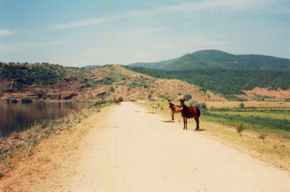
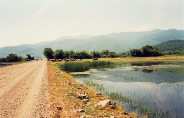
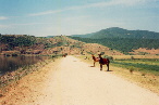 Horses on the western side of the lake... Click here for a bigger (86K) version of this picture
The horses, although curious about you and your bike, will not give chase, however!
The lake lies to the NNE of Thessaloniki, which has a small international airport for those considering flying in for a tour of Northern Greece and/or Halkidiki. My personal experience of flying to/from Greece would suggest avoiding flying with Olympic Airways (I have had too many bad experiences with OA to ever fly with them again) and going for one of the other European carriers which serve Thessaloniki. Thessaloniki Airport (also known as Makedonia Airport since the recent squabbles with the neighbouring state of FYROM - Former Yugoslav Republic of Macedonia) is about 13 km from the centre, and it is quite a busy, dangerous road that brings you into the centre of the city. From there roads lead to Kilkis (50 km) and Serres (about 90 km), from either of which you can access the lake with a ride of between 30 (from Serres) and 80 km (from Kilkis). Both towns are also accessible by train. Serres is clearly rather closer to Lake Kerkini than is Kilkis, but the route from Thessaloniki via Kilkis offers the chance to see Lake Doirani, on the border with FYROM, and a splendid ride in the shadow of the Kerkini range. From Serres it is possible to ride the lanes to Lithotopos, which is at the southernmost tip of the lake, and join the track around the lake from there. An excellent alternative route from Kilkis (which precludes a visit to Lake Doirani, however, is to take the road for Efkarpia out of Kilkis and follow it as it rises up across Mount Disoro (860m) winding through stunning woodland and down to Rodopoli, from where it is 4 kilometres to the village of Kerkini via a lane. In spring the most common hazard on this road is that you will run over a tortoise...! By the way, don't pick one up unless you fancy tortoise urine sprayed all over your bike...!
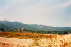
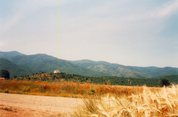
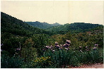 Disoro mountain in Spring Click here for a bigger (35K) version of this picture
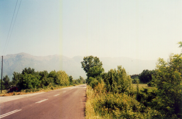
The best place to start your ride round Kerkini is at the village of Kerkini itself. Principal access to Kerkini is from the main road between Serres and Kilkis, which runs parallel with the Kerkini mountain range. The range forms both a natural and a political barrier between Greece and FYROM/Bulgaria to the north. It is a breathtaking sight on a clear day, with the highest peak rising to 2031 metres (6663 feet), for the most part covered in a dense blanket of trees.
 The Kerkini mountain range from the Kilkis-Serres road Click here for a bigger (148K) version of this picture
As can be seen from the picture, the road between Kilkis and Serres is asphalted and of quite good quality, but a warning: it does carry heavy traffic at times, principally because it is one of the two routes to Greece's second city and important port facility, Thessaloniki, routes which are taken by lorries coming from Eastern Europe over the Bulgarian-Greek border at Promahonas, further along towards the east. You may even find yourself having to overtake long, smoky articulated Bulgarian lorries as they grind up some of the hillier parts of the road - these huge lorries seem to have "granny" gears which make mountain bike granny gears look like spring chickens!
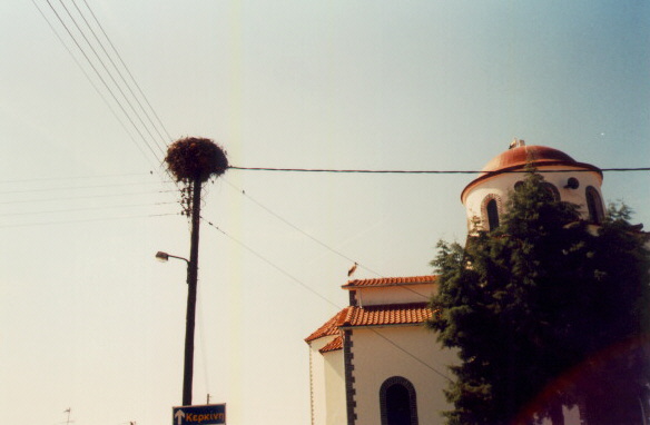
The Lake is signposted from the main road with the words "Kerkini Wetlands" under the Greek words for the same. Firstly you pass through a couple of small villages called Neohori and Livadia, where you should keep an eye open for storks and pelicans in their nests high up on the tops of telegraph and electricity poles. This sight is also to be seen at Lake Doirani, and a friend of mine at the Electricity Board was responsible for designing the special platforms which were put up on the poles to let the magnificent birds nest there in safety (hello Lella!).
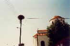 A pelican's nest and pelicans on the church in Livadia Click here for a bigger (57K) version of this picture
From Livadia you follow a tree-lined lane down through delightful countryside to the village of Kerkini. Here it is possible to eat fish fresh from the lake, fried or grilled over charcoal - the latter is absolutely delicious. My recommendation is carp over the charcoal (grivadi sta karvouna for the linguistically adventurous), washed down by a bottle of retsina, although not before the ride - you want to ride round the lake, not fall in it... :)) Fried, the fish is called grivadi sto tigani, and is still a dish to be reckoned with.
Follow the road through the village of Kerkini until you see a sign like this:

which is pronounced "limnee", this being the Greek for "lake". This road will then bring you to the track which leads around the lake. Here, about 200 metres before the road joins the track, there is a small wooden hut on the left where you can buy postcards and posters of the lake and its wildlife. It is also possible to get information about boat trips on the lake, as well as special packages lasting 2 and 3 days which involve trips into the mountains in 4x4 vehicles. The hut is where an environmental-cum-ecotourism organisation called Oikoperiigitis operates from, promoting green tourism on and around Kerkini. If you are interested in more information about the lake, call them on +30 327 41450. I am reliably informed that English is spoken by a member of their staff. I was told that they also offer fenced-off space for camping by the hut, which is encouraging, as there don't appear to be any other camping facilities in the area.
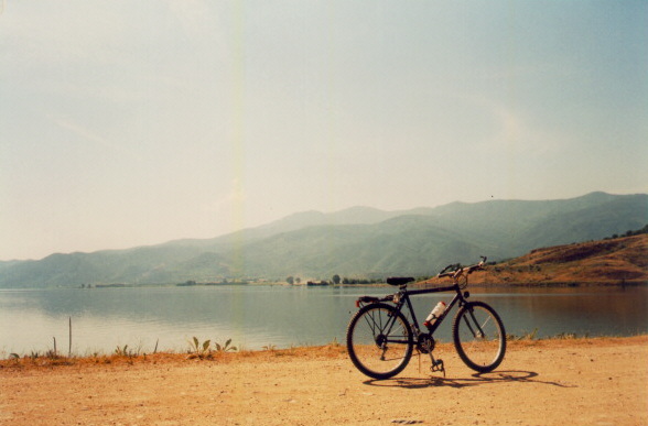
The road leads up to the main track, then, where there are a couple of refreshment kiosks serving refreshments. I took a right turn, deciding to ride round the lake in an anti-clockwise direction, as this meant that the main Kilkis-Serres road section to the north of the lake (about 10 km) would be the last stretch. Almost immediately, I met the horses, and decided to dismount just in case. The horses are untethered, and graze on the bank along which the track leads. The land around the lake is generally lower lying than the lake itself - back in 1928 a US company called John Monks Ulen & Co was contracted to dam the Strymon river and to construct the lake, as the flooding of the river was making the flat land around the present-day lake uncultivable. The company completed the work within 6 years (I suspect it'd take the modern-day Greeks 60 years, 50 years to wade through the bureaucracy and ten to build...!!) and the embankments built on the eastern and western side of the lake are some 34 metres above the surrounding countryside.
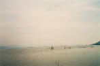
The track takes you south for a short way before briefly joining an asphalt road at the bridge where the Kerkinitis River flows from the west into the lake. Here the track branches off to the east again and starts along the straight shore of the lake down to the village of Lithotopos. This part of the ride is at virtually the same level as the lake surface itself, and occasionally you find yourself riding with water on both sides. In late Spring, when I last toured the lake, the stagnant waters on the right-hand side of the lake were alive with frogs - the constant "rivet rivet" would have made the Muppet Show proud! The track occasionally sheers away from the shore of the lake and rises, as the Krousia mountains (which are mere hills in comparison with the Kerkini range to the north) make the track rise and fall slightly as soon as it edges away from the immediate lakeside. In Spring there are a great many dragonflies along the lake, and as I rode along I suddenly found myself following a particularly fine, irridescent green chappie...
 The low-lying Krousia mountains Click here for a bigger (80K) version of this picture
 Where the track leaves the shore, paths lead down to the shore Click here for a bigger (54K) version of this picture
Another attraction on the lake is the two herds of buffalo (yes, buffalo...). They number some 500 head, and in the heat of summer you can find them up to their necks in the lakewater, keeping cool. A more common sight is the herds of cows by the lakeside on the south of the lake. The track occasionally becomes asphalted road as it follows the lake shore towards Lithotopos at the southern end of the lake, where a dam controls the flow of the lakewater to the south and to its outlet into the Aegean Sea, you pass small pens with makeshift shacks. Lithotopos itself is a very small place, and here the track branches off to the north, while there is access by road from Lithotopos to Serres and beyond.
 A herd of cows on the southern stretch of the track, lake on left, pond on right, Krousia mountains in background Click here for a bigger (93K) version of this picture
The path now makes its way northwards along a 7.5 km embankment some 34 metres above sea level, and you have the lake on your left. The number of submerged trees to be seen increases here, and it is here that you get to see the widest variety of birds take to the air as you cycle along. On the right the land is often substantially lower than the level of the lake, so you also get a good view away to the east across the low-lying fertile lands of the Serres plain. It is possible to take a detour down from the track to the villages of Hrisohorafa (literally Golden Field) and Limnohori (literally Lake Village). In both places you can see more pelicans atop telegraph poles. I was lucky enough to witness a couple of amorous pelicans on a pole going forth and multiplying - the female made a sudden rapid clacking sound with her bill so loud and immediate that I thought something was wrong with my bike...! Clearly a case of "Did the telegraph pole move for you, my dear?" ;-)
 Submerged trees near the shore Click here for a bigger (43K) version of this picture
It is in the northern part of the lake that the lilies grow. The main influx of water is in this part, from the northwest, and large parts of the lake here are covered by white waterlilies (nymphaea alba) in the north-west part and fringed waterlilies (nymphoeides peltata) in the north-east. Again, the best time to see the lilies is in spring. Apparently, about 80 hectares of the lake are covered by lilies. The track here approaches Megalohori (which means Big Village) and it is from Megalohori that you join the main road between Serres and Kilkis. In order to make a full circle round trip of the lake you can turn left and follow the main road for about 10 km, which brings you back to the turning for the village of Kerkini.
 Lilies on the lake Click here for a bigger (73K) version of this picture
Providing it can be combined into a longer tour through this area, a tour of Kerkini makes for a very enjoyable day with a difference. A chance to feel close to Nature and experience the awe of seeing some magnificent wild birds up close, as well as an all-too-rare chance nowadays to ride on a decent surface without constantly being passed by motor vehicles.
Visit my homepage